Researchers from the University of Technology Sydney (UTS) are engaging in a smart technology pilot program to capture, analyse and visualise local environmental data at Melrose Park, a new suburban development site in Sydney’s north-west, with the aim of developing data methodologies for improved liveability.
Delivered in partnership with property developer PAYCE and UTS, the $1.1 million project includes the installation of about 70 environmental sensors throughout the construction site and surrounding residential streets to monitor highly localised conditions including temperature, humidity, air quality, noise and stormwater.
Furthermore, researchers have placed a buoy in the Parramatta River at Ermington Bay to monitor water quality.
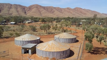
Melrose Park is a 25-hectare brownfield site, where approximately 5000 new residential dwellings are being developed over the next 10 years. This has created a unique opportunity to engage smart technology that can monitor the environment before, during and after construction.
A digital windsock has been installed to display real-time information about weather conditions, including wind speed, temperature, humidity, air quality, noise, rainfall and UV index data.
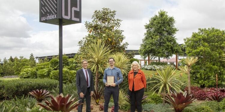
 Andrew Tovey (centre) with ISF colleagues at Melrose Park with one of the sensor displays
UTS Institute for Sustainable Futures Senior Research Consultant Andrew Tovey said the Melrose Park project would provide a data-led foundation for the development of future urban data research methodologies as part of urban liveability research initiatives.
“The Technology for Urban Liveability Program (TULIP) was launched in 2017 by the UTS Institute for Sustainable Futures. It's a smart city program focusing on low-cost distributed environmental monitoring,” he said.
“We are exploring new ways to collect and use data relating to the urban environment to try to tackle some of the growing livability challenges facing Australian cities. Whether its extreme summer heat, air pollution, construction noise or any number of intersecting pressures, detailed, hyper-local real-time data is a powerful new tool at our disposal.”
Livable cities
Tovey said Melrose Park offered the opportunity to start applying the team’s urban livability research on a real-life scenario.
“Melrose Park is a huge site, it’s the establishment of a new suburb. And with that comes the opportunity to really look at how we integrate some of these smart technologies from day one,” he said.
“While there was a huge amount we could do, we went in with the aim of achieving a baseline data capture for the site so we could see how it changes over time and potentially produce better design decisions in future.”
While a lot of the design decisions for Melrose Park had already been locked in before the UTS team started their applied research, Tovey said the work aims to produce more insight into urban development environments moving forward.
“We were working with PAYCE and Council to develop and test operational use cases for data, particularly live data, which might start to justify the investment in this sort of technology into the future,” he said.
“We monitored particulates and noise on and around the construction site because we wanted to see if we could capture the direct impacts of construction on the surrounding community. The idea is that the data can help PAYCE to understand the impacts of its activity better.
“Our work at Melrose Park is an exercise in playing with methodology for data capture that could then be applied in future contexts. We hope to set a precedent or a reference point so that the developed methodology may be able to help with future development sites.”
Monitoring conditions
The project involved deployment of low-cost sensors across the development site and into surrounding streets and parks. Devices transmit readings every fifteen minutes via a communication technology called LoRaWAN, with data visible in real time through a dashboard.
“We recognise localised variation in things like heat and air quality as something inherent to the urban environment. We want to understand that spatial complexity but to do that we need to use a lot of sensors, distributed over a wide area,” Tovey said.
“The only affordable way to do that is to use low-cost devices but there’s uncertainty about how they behave or how best to work with them. In many ways this was an experiment to explore what can be usefully achieved with them.
“We're getting this granularity about place that we were never able to get before. The challenge is of course, how we interpret that data.”
While the sensors aim to capture data for a range of different environmental stressors, Tovey said part of the data profile includes rainwater, soil moisture and water quality impacts.
“For stormwater, we had a couple of major operational use cases that we were exploring and these defined the design of the system we installed. A development site has to deal with stormwater management throughout construction and two big concerns are localised flooding and erosion, leading to sediment loss,” he said.
“Council requires PAYCE to implement stormwater management measures to reduce flood and erosion risk. The relative effectiveness of these measures is not well understood so the idea is that these sensor technologies might offer new ways of understanding and improving them.
“We wanted to see what we could do with relatively low-cost technology. There’s technology available to get very reliable and accurate data about stormwater, but it's expensive.
“Furthermore, you need lots of that technology, it needs to be maintained and, in the context of Melrose Park, it's not yet clear what the operational use case is for the data — so how do you justify the cost?”
“We wanted to see what we could achieve using low-cost sensors, as future applications of the methodology will likely rest on the process being cost-effective.”
Sensors working overtime
Tovey said the water-related data capture includes an onsite weather station, and sensors that monitor soil moisture, overland flow, stormwater outflow levels and river water quality.
While the data capture and analysis has not yet come to fruition, Tovey said the process has been implemented in order to gain better insight into how smart urban data capture methodologies can work to improve the suburb's livability in the long term, and inform future planning.
“The main learnings that have come out of this exercise have been around the methodology and the planning of that system, how you put it all together, and how you make it work and get usable data to do analysis on,” he said.
The real-time data, which paints a picture of the health of the Melrose Park site and its surrounding environment, can be viewed on the City of Parramatta’s community dashboard.
Share